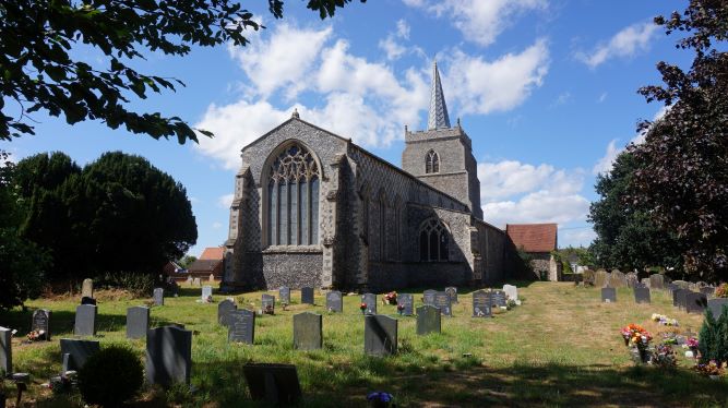
Church of St James Great Ellingham
Property deeds are an extremely useful source of information for local and family historians. Not least for providing details of the owners and occupiers of properties over the years. However, deeds can also provide other snippets of information, particularly with regard to adjoining or nearby land.
In this particular case, whilst looking through a bundle of deeds relating to a property in Church Street, I found reference to an addition to the churchyard of St James’s Church.
Abstract of Title
An ‘Abstract of Title’ provides extracts (or abstracts) of documents showing a sequence of ownership of a property (‘Title’). A particular Abstract of Title relating to the property later known as ‘Ye Olde Thatche Shoppe’, begins with an extract of a 1911 Conveyance.
This Deed (dated 13th September, 1911), relates to Frederick Neeve‘s purchase of the shop and dwelling house. The extract mentions that the premises and land is (then) partly bounded on the north by the piece of land ‘recently acquired from the vendor as an addition to the churchyard‘. The vendor at this time was Annie Gladden.
Gift or for Payment?
The abstract gives no further details of the church’s acquisition of the land. Accordingly, I do not know if the land was gifted to the church or whether it was purchased from Annie Gladden.
Location of Addition to Churchyard
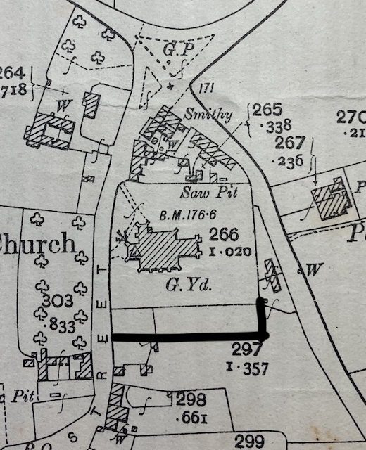
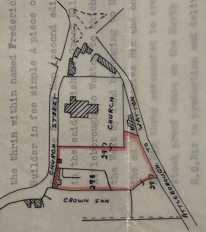
However, we know that the churchyard was extended towards the south.
The above maps each show the churchyard after it was extended. [The northern point being to the top of each map].
The thick black line marked on the extract from a 1906 Ordnance Survey Map (left) shows the approximate position of the new southern boundary. The later plan (on the right) also shows the new southern boundary – the red line crossing ‘297’. of the churchyard. The red edging shows the extent of Ye Olde Thatche Shoppe premises at that time, the northern boundary of which adjoins the churchyard.
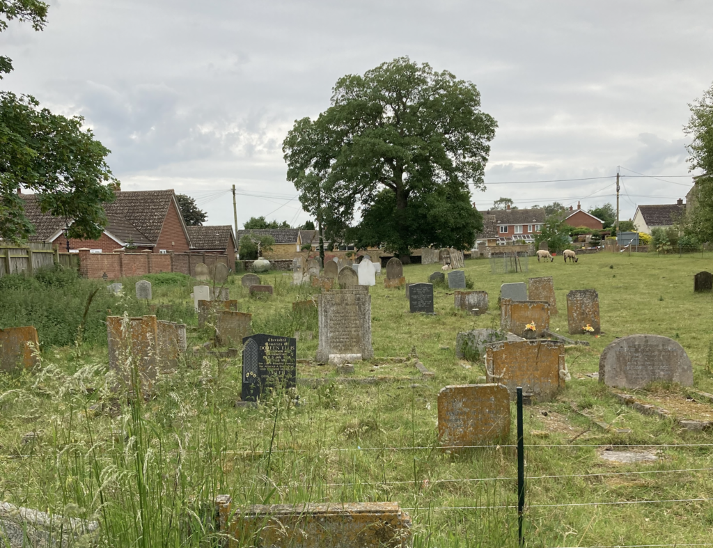
On a physical inspection of the churchyard, it is clear that the southern most part is indeed lower than the rest of the churchyard. In addition, the burials within this part of the churchyard do not appear to pre-date 1911.
Church Wall
Today, the churchyard of St James is surrounded by a flint wall on two sides – along the western boundary on Church Street running northwards along the boundary with the property immediately to the north, and continuing round to the small gate on the Attleborough Road. I wonder whether the flint wall ever surrounded the entire churchyard notwithstanding the addition c.1911.
Nevertheless, given that the flint wall on the western boundary of the churchyard extends fully to the southern boundary, the flint wall must have been extended on the acquisition of the additional land.
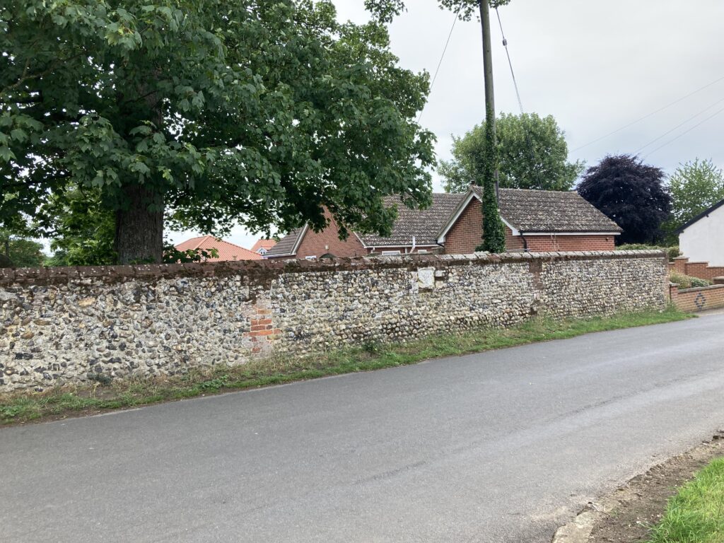
Looking for Clues
The above photograph shows the flint wall at the southern part of the western boundary of the churchyard. I wonder whether the original wall (before the addition) stopped at the point where the red bricks are set into the wall.
However, the insertion of the red bricks may well have been put in to patch up damage to the wall. Nevertheless, the arrangement of the flints in the wall on either side of the bricks appears to be different.
There is also another patch to the right of the wall in the photograph. Again, this could be a repair.
The memorial tablet to King Edward VII is towards the top of the wall between the two patches. This could only have been placed in the wall after the King died in May 1910.
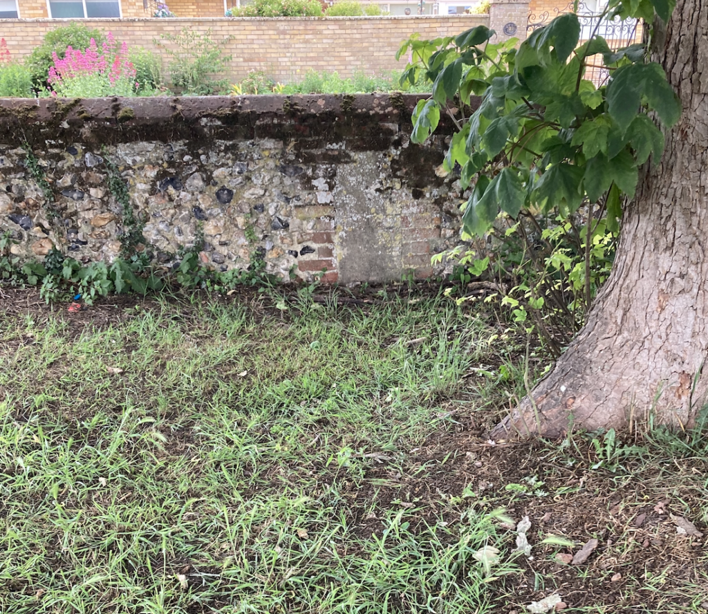
On the inside of the wall, there are two columns of bricks either side of a cemented area. This is clearly visible in the above photograph. It is in the same position as the red bricks on the outside of the wall (which I mention earlier).
Again this suggests a change, but does it add weight to the thought that the original wall stopped at that point before the churchyard was extended c.1911?
Pre-1914 Postcard
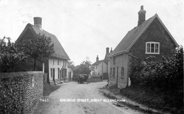
Church Street before 1914
The flint wall to the churchyard is clearly visible on the above postcard which pre-dates 1914. What looks to be the memorial tablet to the late King Edward VII is also visible in the wall.
The flint-work surrounding the tablet looks different to that of the wall to the left of the photograph. However, this area could be slightly out of focus and perhaps distorted. Accordingly, it is difficult to see from the photograph the actual length of the wall.
Conclusion
What do we actually know?
We know is there was an addition to the churchyard land around 1911.
However, we do not know for certain whether or not the land was was a gift to the Church. Further, we do not know for sure the full extent of the addition to the churchyard.
Source:
Extract from Conveyance dated 13th September, 1911, referred to in a 1963 Abstract of Title for Premises in Church Street, Great Ellingham. Courtesy T & E Betts