In the past, gravel and clay pits (together with water pits) may well have served much of the building needs in the village.
A Particulars and Valuation c.1800 relating to the Inclosures of Great Ellingham, tells us where the village’s allotmnets for the gravel, clay and water pits were at this time:
- Low Common 1a 0r 0p
- Bush Green 0a 2r 24p
- Broad Common 1a 0r 30p
- Ravenscroft 0a 2r 0p
- Town Green for Water Pit 0a 0r 10p
Where were the Gravel & Clay Pits?
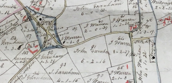
Extract from 1802 Map of Great Ellingham. Original held at Norfolk Record Office. Russell James Colman Plans.
Cat. Ref. C/Ca 1/84. With kind permission of NRO
The black dot on the left of the above extract from an 1802 Map of Great Ellingham, shows the position of the clay pit allotment on Bush Green. The black dot to the right of the map shows the position of the gravel pit allotment on Low Common.
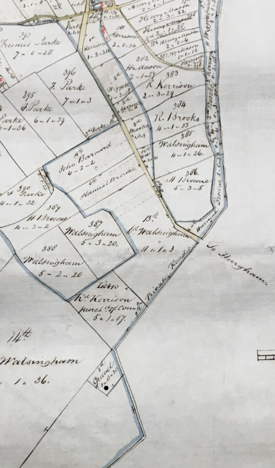
Extract from 1802 Map of Great Ellingham. Original held at Norfolk Record Office. Russell James Colman Plans.
Cat. Ref. C/Ca 1/84. With kind permission of NRO
The above extract of the 1802 map captures the western end of Penhill Road. The black dot shows the gravel allotment of two roods on Ravenscroft, just to the west of the buildings of what are today Penhill Farm West and Home Cottage Farm.
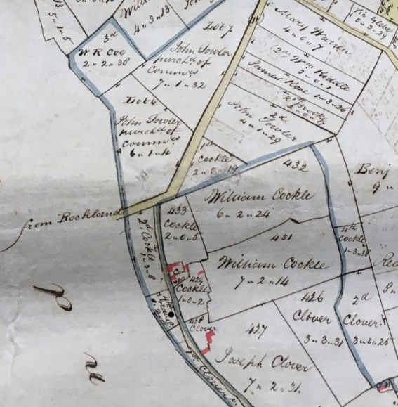
Extract from 1802 Map of Great Ellingham. Original held at Norfolk Record Office. Russell James Colman Plans.
Cat. Ref. C/Ca 1/84. With kind permission of NRO
The above extract of the 1802 map shows the southern end of Long Street (“to Hargham“). The black dot identifies the gravel allotment on Broad Common.
Where was the Water Pit?
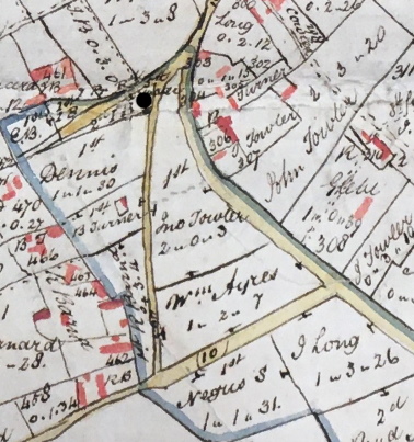
Extract from 1802 Map of Great Ellingham. Original held at Norfolk Record Office. Russell James Colman Plans. Cat. Ref. C/Ca 1/84. With kind permission of NRO
The black dot on the above extract from the same 1802 map shows the position of the water pit at Town Green.
Today, over 200 years later, evidence of this water pit can still be seen in Town Green!
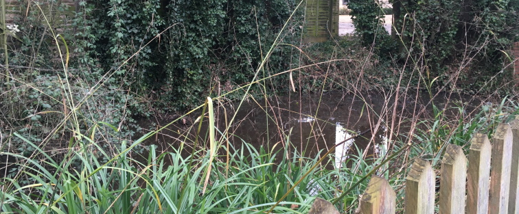
The remains of the Water Pit in Town Green. Photograph taken February 2021
Sources:
1802 Russell James Colman Plans. Great Ellingham. Norfolk Record Office. Catalogue Ref. NRO, C/Ca 1/84.
1800 Inclosure Commissioner’s Particulars and Valuation, Great Ellingham. Norfolk Record Office. Catalogue Ref: NRO, MC 2213/119