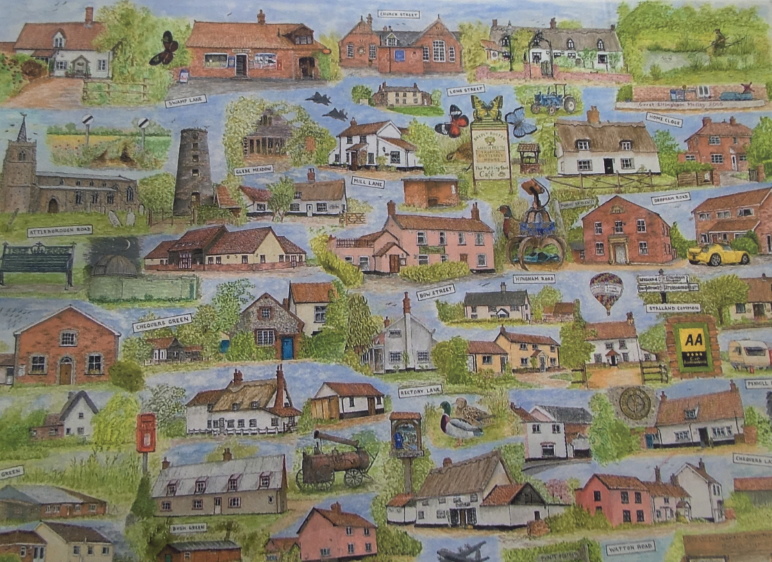
Extract from Painting by B Aldous c.2006. Courtesy Angela Crocker & the Aldous family
Population
Although Great Ellingham saw a decrease in the population during the 19th century and the early part of the 20th century, the populace steadily increased from the 1920s.
1831-1921
Back in 1831, there were some 882 people living in the village. By 1911, this number had decreased to 611, and decreased further to 562 in post-war 1921.
1931-1940s
However by 1931, the head-count had slightly increased to 573. With the United States Army Air Corp based at Deopham Green Airfield during WWII, many ancillary buildings were built in Great Ellingham. The existence of the camp may well have increased the number of people living in the village during this time.
2001
Nevertheless by 2001 the population of Great Ellingham had nearly doubled standing at 1,108.
This increase can be attributed to the gradual increase in the building of houses in the village.
Development of the Village
The first council houses were built c.1928 in Mill Lane, with more council houses erected in Hingham Road c.1939.
In the late 1940s, further council housing in the form of ‘swedish style houses‘ were built along the Hingham Road, followed by a much larger council estate behind these houses.
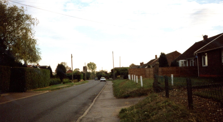
Chequers Lane. Photograph taken 1990s
More dwellings popped up in Chequers Lane, with further bungalows built in Mill Lane. Additional dwellings also began to appear in other parts of the village, such as Long Street and Bow Street.
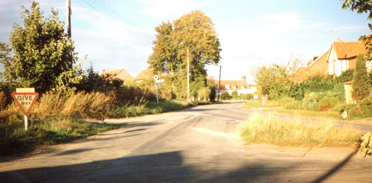
Town Green & Long Street before the building of Glebe Meadow. Photograph 1990s
The 1970s saw the development of Chequers Green and Rectory Lane. These developments were followed by further individual dwellings and small developments, including Glebe Meadow.
Today, and in line with many other towns and villages in Norfolk (and the rest of the country), there are several new-build developments taking place in Great Ellingham.
Bowsfield
One such development is Bowsfield.
‘Bowsfield’ may take its name from the fact that the development land lies between Hingham Road and Bow Street. On the other hand, it may be because the main road on the development is ‘Bowden Road’.
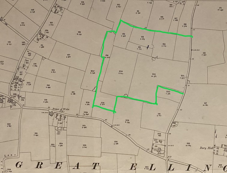
Extract from 1906 Ordnance Survey Map. North point is top of map. Second Edition. Author’s Collection
The green edging on the above extract from a 1906 O.S. map of Great Ellingham shows the approximate area of the Bowsfield development.
The map clearly shows the school and school house at the crossroads of the B1077 Attleborough to Watton Road, with Chequers Lane and Hingham Road.
The council housing built c.1939 was erected on the piece of land numbered 200 (on the map), with the majority of the later council housing estate built on enclosures numbered 199 and 202.
Field Names
For centuries, fields have been given names. Sometimes, these names can be traced back to Saxon times!
By giving fields specific names, it was easier and practical for illiterate farm workers to identify the correct field to work on. A farmer would not want his labourer ploughing or hedging the wrong field!
Field names can derive from the site or location, or by the lie of the land as well as ownership. It may also be influenced by other things such as the soil, crops, livestock and plants.
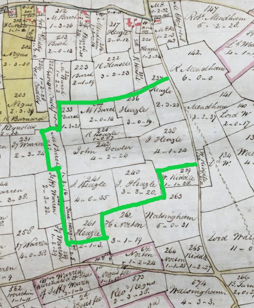
Extract from 1802 Map of Great Ellingham. Original held at Norfolk Record Office. Russell James Colman Plans. Cat. Ref. C/Ca 1/84. With kind permission of NRO
The green edging on the above extract from the Inclosure Map for Great Ellingham c.1802, shows (again) the approximate extent of the Bowsfield development. The map also clearly shows the various fields with the names of the owners, the size of the enclosure and a number.
Particulars & Valuation 1800
The numbering used in the schedules to the Particulars & Valuation of Great Ellingham compiled in 1800 concurs with the numbering on the plan. Accordingly, the Particulars & Valuation provide us with the names of the owners and the names of the fields! Consequently, we have the names of the fields within the Bowsfield development:
| Number | Field Name |
| 232 | Further Pightle |
| 233 | Two Acres |
| 234 | New Broke Up Meadow |
| 235 (erroneously 225 on map) | Hodges |
| 236 | Upper Grass Close |
| 237 | Bramble Pightle |
| 238 | Corries (also found as Corrys) |
| 240 | Polls (also found as Poles) |
| 241 | Clay Pit Close (Claypit Close) |
| 242 | Parletts Close |
| 260 | Headmere (also found as Headmeer) |
| 261 | Headmere (also found as Headmeer) |
Some of these field names may have already been in use for centuries when they were recorded in the Particulars & Valuation of 1800.
Inclosures
Although the Great Ellingham Inclosure Act is dated 1799, the practice of enclosing land in England began much earlier by formal and, sometimes, informal agreements. However, by the mid 18th century, enclosures by Acts of Parliament became standard practice.
Until the ‘Inclosures’, most fields were large and open with no hedges or fencing – the ‘open-field system‘. These large open fields were divided into narrow strips. Often villagers were allocated strips of land on several different fields in the village. It was a much fairer way of ensuring that everyone had a chance to cultivate some good productive land.
Bowsfield Field Names
At the turn of the 19th century, there is only one field in Great Ellingham called ‘Parletts Close’. However, there are five fields with the name ‘Clay Pit Close’ scattered around the village.
There are four fields with the name ‘Headmere’ (or ‘Headmeer’) – two of which are found on the Bowsfield development land. The use of the field name ‘Corries’ (also found as Corrys and Corris) is exclusive to the Bowsfield land.
‘Bramble Pightle’ is also exclusive to the land now forming Bowsfield. However, there is a parcel of land with the name ‘Bramble Row’ on the southern side of Mill Lane (track).
The use of ‘Grass’ is common in Great Ellingham’s field names. In 1800, three parcels of land are named ‘Grass Pightle’, three fields called ‘Grass Piece’ but only one ‘Lower Grass Pightle’ and one ‘Upper Grass Close’.
It is no surprise that the word ‘Acres’ is used 85 times in the names of fields! However, ‘New Broke Up’ is used just four times.
Road Names on Bowsfield Development
I could not be more delighted to learn that the majority of the roads on the Bowsfield development will bear some of the historical field names.
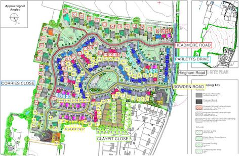
Confirmed Road Names for the Bowsfield Development. Courtesy Collins Project Delivery
‘Corries’ and ‘Parletts’ are unique to the Bowsfield development. Accordingly, it seems right that these field names will ‘live on’ along with ‘Headmere’ and ‘Clay Pit’. The development will retain a wonderful link to the past!
I am grateful to the developers (and to all those involved in the process of naming roads), for considering and agreeing my suggestion.
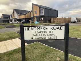
Photograph taken 20 November 2023
Bowden Road
However, this blog will not be complete if I do not mention the name of what is probably the main road through development: Bowden Road. The naming of this road too is linked to the past.
For many years Mike Bowden was a resident of the village. He was a stalwart member of the Recreation Centre Committee. Sadly, Mike died in November, 2018.
The Parish Council thought it fitting that Mike’s enormous contribution to the village should be acknowledged. What better way than to name a road in his honour – Bowden Road.
Sources:
1800 Inclosure Commissioner’s Particulars and Valuation, Great Ellingham. Norfolk Record Office. Catalogue Ref: NRO, MC 2213/119
1802 Russell James Colman Plans. Great Ellingham. Catalogue Ref. C/Ca 1/84
https://www.genuki.org.uk/big/eng/NFK/Ellingham_Great accessed 14 January 2019
Kelly’s Directories 1937 & 1925
https://www.citypopulation.de/en/uk/eastofengland/admin/breckland/E04006120__great_ellingham/
Thanks to Tim Betts